
|

|

|

|

|

|

|

|

|
|
|
|
|
|
|
|
|
|
|
 (15 Feb 2010) Header.jpg)
|
|


|
|
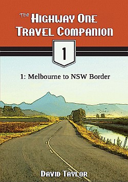
The e-books There are custom colour maps, much more detailed directions and stories, charming illustrations and much more in the Highway One Travel Companion e-books. If you'd like to explore deeper into Highway One's attractions, and maybe do a little "highway archaeology" on Old Highway One then you may be interested in getting some of my in-depth e-books to be your travel companions. The introductory volume is free (at Smashwords) and the others are great value at only US$1.99 to US$2.99 each. You can find them at Amazon or Smashwords or use the links below to access them direct.
Click the links below to read more or download: |
  |
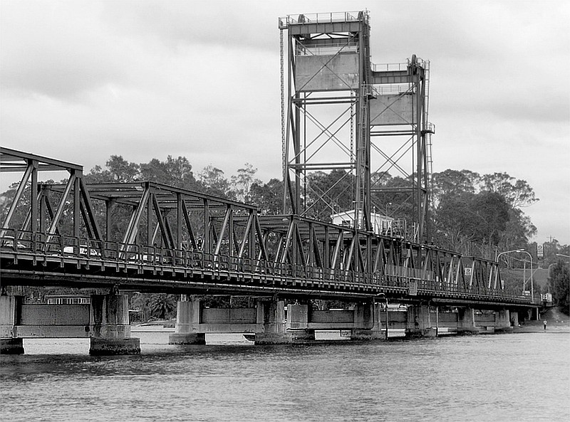
| Timbillica | ||
 Full.jpg)
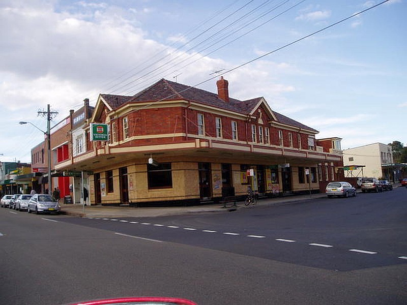
The Old Highway One section at Timbillica can be walked but not driven nowdays. |
 Full.jpg)
Some interesting relics still linger from the Old Highway One bridge at Timbillica. |
|
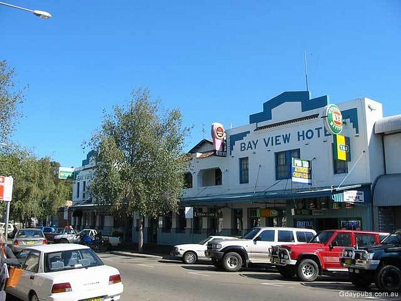
| Eden | ||
 Full.jpg)
Check out the classic 1847 Great Southern Hotel in Eden. |
 Full.jpg)
Classic NR1 road sign near Eden, alas almost all now replaced with "A1" or "M1" patches. |
 Full.jpg)
Eden's Hotel Australasia. |
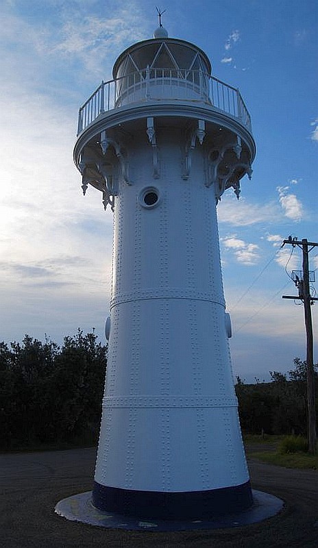
 Full.jpg)
Eden lighthouse. |
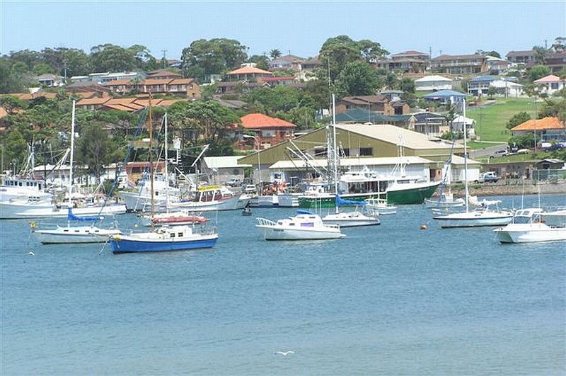
 Full.jpg)
Looking from Eden south across Twofold Bay toward Boydtown. |
|
| Pambula | ||
 (31 Jan 2011) Full.jpg)
Historic 1860 Pambula Court House. |
 (31 Jan 2011) Full.jpg)
Pambula's 1867 St Peter's Catholic Church. |
 (31 Jan 2011) Full.jpg)
The construction of the Commercial Hotel in Pambula dates right back to 1878. |
| Yellow Pinch | ||
 Full.jpg)
Old Highway One once followed a more winding path north out of Merimbula. Merimbula Dr and Yellow Pinch Dr are some of the easily accessible remnants, plus look out just west of the west end of the former Yellow Pinch Dr alignment on the south side of the highway for the hidden Old Highway One section off Milligandi Rd. |
||
| Wolumla | ||
 Wolumla Hotel (was Railway Hotel) (11 Feb 2010) Full.jpg)
Take a charming drive on an Old Highway One alignment through the historic village of Wolumla (pop. 380). |
 former Post Office (11 Feb 2010) Full.jpg)
The former Post Office on Scott St graces Old Highway One in Wolumla. |
 former Gunpowder Trading Post Hotel (11 Feb 2010) Full.jpg)
The historic former Gunpowder Trading Post Hotel was another of the 19 hotels and bars in the old days in Wolumla! |
 All Saints Catholic Church (11 Feb 2010) Full.jpg)
The timber-built All Saints Catholic Church in Wolumla dates back to 1889. |
 (11 Feb 2010) Full.jpg)
Scott St is part of Old Highway One through Wolumla. |
 St Lukes Anglican Church 1925 2 (11 Feb 2010) Full.jpg)
Wolumla's St Lukes Anglican Church was built in 1925. |
 becomes private land - south end (11 Feb 2010) Full.jpg)
Coral Park Rd is another Old Highway One alignment. Only about 250m is drivable as it enters private land at a locked gate. |
 becomes private land - south end (11 Feb 2010) Full.jpg)
Cherry Lane offers 1.5km of classic Old Highway One in the low hills west of the modern highway. Like Coral Park Rd, through passage ends where the old road passes through a gate into private property. |
|
| Bega | ||
 Full.jpg)
Highway One was realigned through Bega in 1975 and a future full bypass is planned. While some of the old road has been lost to redevelopment and a little bit is now private land, much is still discoverable, and drivable, for intrepid explorers! Bega Cheese runs a
Heritage Centre featuring a Dairy Museum, merchandise and coffee shop; it's located together with the Visitor Information Centre. |
(11 Feb 2010) Full.jpg)
The old Central Hotel dates back to 1890. |
 Full.jpg)
Bega's clock tower stands at a major intersection of A1 Princes Highway (modern Highway One) in town. |
 Full.jpg)
The former Kings Theatre is now a furniture outlet although some of the old cinema equipment remains in place. |
 Full.jpg)
Bega's stately 1880 Red Cross Building. |
 Full.jpg)
The VERY art deco Grand Hotel is a standout in downtown Bega. |
 Full.jpg)
Bega's 1888 Commercial Hotel is strategically placed next to the clock tower. |
 Full.jpg)
Historic old shops on Bega's main street. |
 Full.jpg)
Lovely old terrace house in Bega. |
 Full.jpg)
Bega's 1878 St John the Evangelist Anglican Church is a lovely and substantial old building for a small town. |
||
| Quaama | ||
 Full.jpg)
Don't miss the Old Highway One alignment through Quaama (pop. 144). This lovely old house speaks of the history here. |
 Full.jpg)
A historic former shop in Quaama. |
 Full.jpg)
Quaama's 1902 School of Arts building. |
 (12 Feb 2010) Full.jpg)
The west end of Cobargo St, one of the Old Highway One alignments in Quaama, dead-ends at the cutting carrying the modern road. Note the old yellow centre lines still visible. |
||
| Tilba Tilba & Central Tilba | ||
 Full.jpg)
This classic Old Highway One loop passes through not one but TWO National Trust listed historic villages in less than 4km! Tilba Tilba (local area pop. 275) is the more southerly of the two and is a real charmer.
|
||
| Narooma | ||
Narooma (pop. 3,100) is an unspoilt small, seaside town prettily located on the Eurobodalla Nature Coast's Wagonga Inlet. The 1914 Uniting Church in Narooma is a highlight. |
||
| Bodalla | ||
 (1 Feb 2011) Full.jpg)
Bodalla (pop. 960) was originally a centre for the dairy industry, but now also offers a tourist destination with a different flavour to the coastal resorts nearby. |
 Altar (1 Feb 2011) Full.jpg)
The historic interior of All Saints Anglican Church in Bodalla. |
 Full.jpg)
Bodalla is home to another Highway One Giant - the Big Cheese. It's at the north end of town outside the long closed and abandoned Big Cheese Centre on the east side of the Prince Highway. |
| Moruya | ||
 Full.jpg)
Moruya (pop. 2,432) is the administrative centre for the Eurobodalla Coast region. It was established in the mid-1800s and thrived as a gateway to nearby goldfields. The area is known for its granite, which was used on the Sydney Harbour Bridge and in
other famous landmarks. |
 Full.jpg)
Moruya's Adelaide Hotel offers another dining and "refreshment" option. |
 Full.jpg)
Beautiful historic building now a private residence in Moruya. |
(12 Feb 2010) Full.jpg)
The 1928 former Commonwealth Bank in Moruya. |
 Full.jpg)
Moruya's former Shire offices now serve as a Medical Centre. |
 Full.jpg)
The old granite industry wharf is rotting away. |
 Full.jpg)
The historic Mechanics Institute in Moruya. |
 Full.jpg)
Moruya's 1889 Sacred Heart Catholic Church (constructed from local granite). |
 Full.jpg)
Moruya's 1891 St John's Anglican Church (its Rectory dates back to 1874). |
| Mogo | ||
Just south of Batemans Bay, Mogo (pop. 257) is a historic mining township (1857 gold rush) and tourist destination. |
||
| Batemans Bay | ||
Originally a timber and fishing town, Batemans Bay (pop. 10,845) is now the centre of the popular holiday coast and hinterland all around. |
The 1892 Bayview Hotel graces Old Highway One through Batemans Bay. |
 Full.jpg)
Bateman Bay's Bayview Hotel's mixed grill lunch is INDEED as good as it looks! |
| Ulladulla | ||
Ulladulla (pop. 10,298) was established back in 1828. |
Scenic Ulladulla harbour. |
|
| Yatte Yattah | ||
 south end of abandoned road beyond road closure(14 Feb 2010) Full.jpg)
"Bloodwood Rd" Former Alignment - although the remnant road only runs about 150m before being blocked, the block can be easily got around to access another 100m of abandoned road in good condition. NOTE: I strongly recommend not driving on the blocked-off section here as it is quite high above, and right on the edge of, the embankment above the modern highway and stability cannot be guaranteed! Walk it on foot instead. |
 (14 Feb 2010) Full.jpg)
"Myrtle Gully Rd" Former Alignment - is among the most interesting old alignments and not to be missed! Bypassed in 1997, the old road winds down and around for about 800m before appearing to end at the usual "end of road" marker. Park by the roadside at the "end of road" and walk through along the former alignment. |
 abandoned northern section view to current H1 (14 Feb 2010) Full.jpg)
What a treat! The old road is still there as it passes for another 200m through an old cutting in the rock hillside complete with the old-style round timber white-painted posts and wire-mesh safety barrier. The modern highway thunders by at least 20m above, over a very long concrete bridge. |
| Tomerong | ||
 Full.jpg)
Tomerong (pop. 295) was first settled back in the 1850s. The 1926 School of Arts building opposite the Public School is a great example of its type. |
 south end looking north (14 Feb 2010) Full.jpg)
Kells Rd is just part of the "Tomerong Loop" Former Alignment of Old Highway One through Tomerong. |
|
| Falls Creek | ||
 Full.jpg)
Split in two by a now-collapsed bridge over Parma Creek, the Old Highway One "Falls Creek" Former Alignment is very much worth investigating. |
 Full.jpg)
The southern approach to the well-rotted Old Highway One bridge over Parma Creek in Falls Creek. |
 Full.jpg)
This overgrown sign at the Old Highway One bridge over Parma Creek in Falls Creek says "Pedestrian and bicycle usage on bridge only" - I'd rather not risk it myself! |
 (14 Feb 2010) Full.jpg)
Vidler Rd is the northern continuation of Old Highway One in Falls Creek. |
||
| Nowra | ||
 (1 Feb 2011) Full.jpg)
Bypassed in 1981, this alignment of Old Highway One used to travel a historic route north through Nowra. The old alignment offers great access to an interesting historical walk through town. |
 (1 Feb 2011) Full.jpg)
Nowra's All Saints Anglican Church dates back to 1900. |
 (1886) (1 Feb 2011) Full.jpg)
The Australian Hotel in Nowra dates right back to 1996 as formerly the Imperial and before that the Empire Hotel. |
 (1 Feb 2011) Full.jpg)
Nowra's historic Bridge Hotel (1886). |
 (1 Feb 2011) Full.jpg)
St Michael's Catholic Church (1877) in Nowra. |
 (1 Feb 2011) Full.jpg)
Nowra's lovely stone Uniting Church also dates back to 1877. |
| Berry | ||
 (1884) (15 Feb 2010) Full.jpg)
Beautiful little Berry (pop. 1,932) was first settled in the early 1800s. |
 (15 Feb 2010) Full.jpg)
Historic Berry Hotel (1888). |
 Full.jpg)
Berry's Great Southern Hotel features some unusual roof ornaments! |
 Full.jpg)
A lovingly restored old shop in Berry. |
 Full.jpg)
More classy and historic old shops in Berry maintained in wonderful condition. |
 (15 Feb 2010) Full.jpg)
Berry's former 1886 Post & Telegraph Office is another standout. |
| Gerringong | ||
 Full.jpg)
Gerringong (bypassed 1938 in pre-Highway One days) (pop. 3,588) is a small rural and dairy industry town just east of modern Highway One. |
||
| Kiama | ||
 (15 Feb 2010) Full.jpg)
Kiama (pop. 12,286) is a popular coastal town in a stunning natural setting between rolling green hinterland and a striking rocky coastline with sandy beaches. No visit to Kiama is complete without taking in the famous blowhole(s). Settled originally for timber in the
1820s, Kiama is now an administrative and service centre for the region, as well as a major tourist destination. Old Highway One through Kiama was bypassed 1987, but the old road through Bombo, Kiama Downs and Minamurra was only recently bypassed in 2005. |
 Full.jpg)
Kiama's famous blowhole is an interesting geological feature. |
 (15 Feb 2010) Full.jpg)
The imposing 1815 Kiama Council Chambers. |
 (15 Feb 2010) Full.jpg)
Kiama's 1891 Grand Hotel features three floors of grandness, plus great counter lunches! |
||
| Wollongong | ||
 Full.jpg)
On track through Wollongong on Old Highway One. Bypassed in stages up until the mid-1970s, the old road takes us right through Wollongong's suburbs and the heart of the historic CBD. |
)(15 Feb 2010) Full.jpg)
Wollongong's 1876 Illawarra Museum occupies the former Post and Telegraph Office. |
 (15 Feb 2010) Full.jpg)
The 1855 Congregational Church in downtown Wollongong. |
 Full.jpg)
Wollongong's imposing St Francis Xavier Catholic Cathedral. |
 Full.jpg)
Historic 1859 St Michael's Anglican Church. |
|
| Sutherland | ||
 Full.jpg)
Bypassed in 1975, an interesting Old Highway One alignment runs right through downtown Sutherland. |
Historic Boyles Hotel is a refreshing stp on Old Highway One in Sutherland. |
|
| Sydney | ||
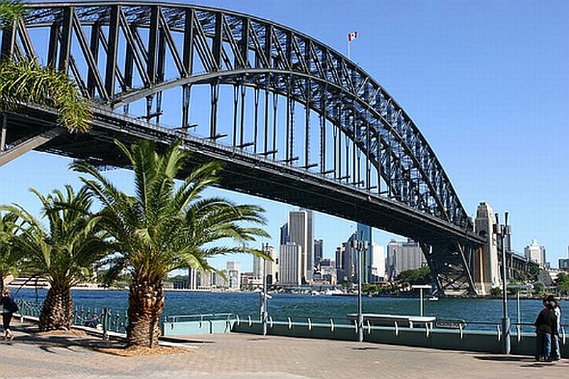
Founded with the arrival of the First Fleet in 1788, Sydney (pop. around 4.5 million) is Australia's first and largest city. Stunningly set on Sydney Harbour, surrounded by National Parks and beautiful coastline, Sydney is a key national centre for commerce and industry. |
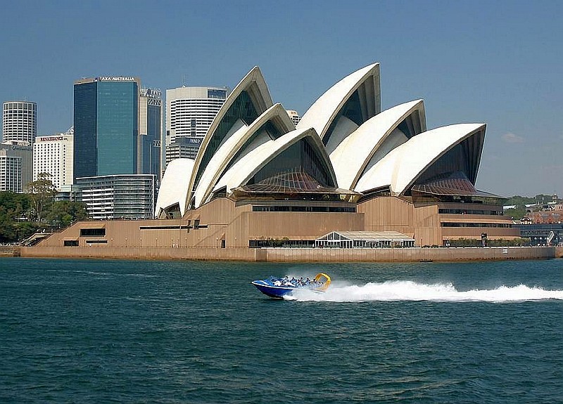
Beautiful Sydney Opera House is another Highway One icon on Sydney Harbour. |
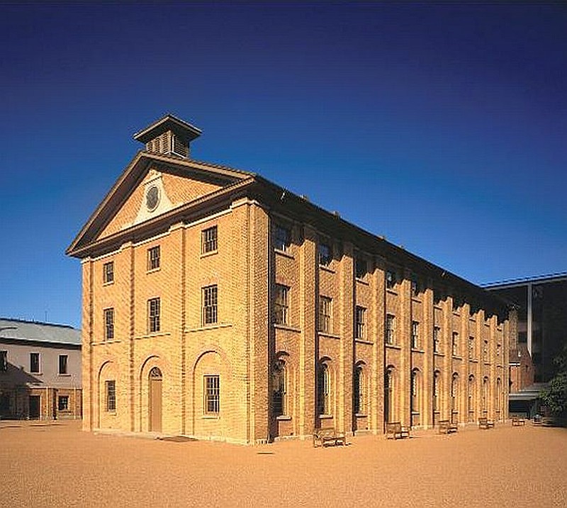
1819 Hyde Park Barracks is just one of dozens of historic highlights all around Sydney CBD. |
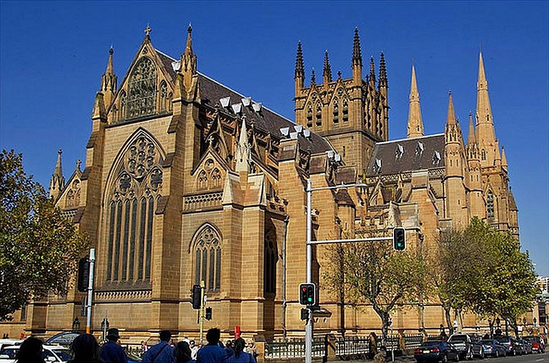
1865 St Mary's Catholic Cathedral is another must-see in downtown Sydney. |
||
| Cowan | ||
 Full.jpg)
On the east side of Old Highway One, not far drom the roar of the M1 just north of Cowan, look out for Pie in the Sky; a classic Aussie road food stop. |
||
| Mooney Mooney Creek | ||
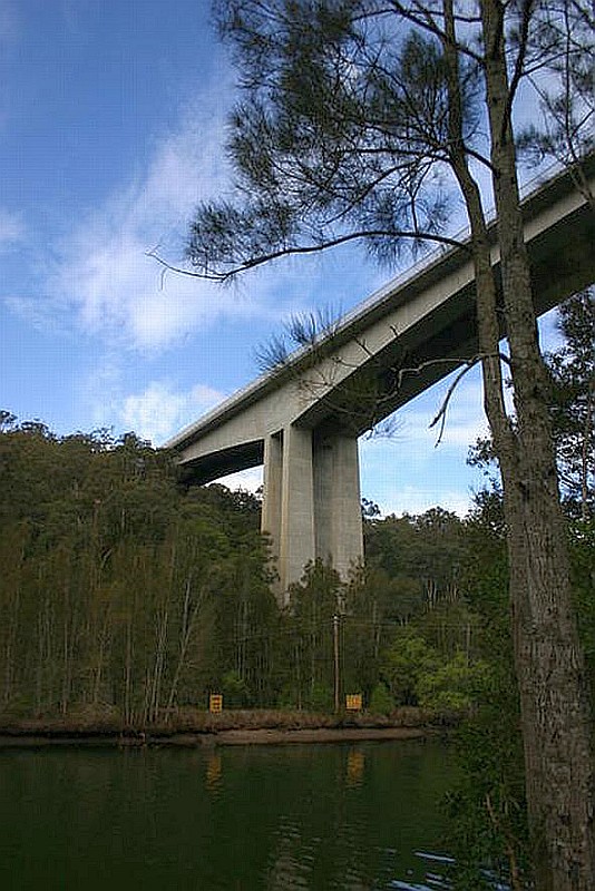
The Warren steel truss Old Highway One Mooney Mooney Highway Bridge was built in 1930. A short walk upstream will reward with views up to the amazing 75m high, 480m long modern freeway bridge acrrying the M1 Pacific Motorway. |
||
| Peats Ridge | ||
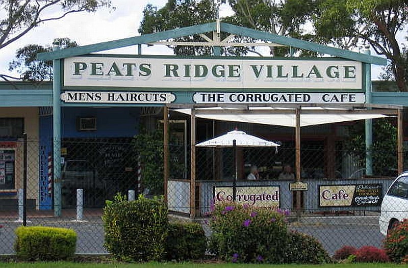
A mid-1960s freeway-style loop of Old Highway One passed north through Peats Ridge and then back south to rejoin the modern freeway alignment near Somersby. The old freeway loop was bypassed by a new and much more direct freeway alignment in the mid-1980s. The realignment led to the closure of the famous Oak Milk Bar (closed 1986), which they say, in addition to other great road food, once served literally thousands of "Oak Shakes" daily. Customers included highway travellers (like me in the early 1970s) and passengers from as many as 150 different buses per day. Although the Oak Milk Bar is closed, the old building lives on as "Peats Ridge Village". |
||
| Gosford | ||
Less than 90km north of Sydney, Gosford (pop. 158,157) is located on Brisbane Water and surrounded by long beaches and National Parks. |
||
| Wyong | ||
 Full.jpg)
Wyong (pop. 3,116, est. 1881) is perfectly placed as the jumping-off point for The Entrance, Tuggerah Lake and the other smaller lakes south of Lake Macquarie. |
 Full.jpg)
The historic 1889 Royal Hotel in Wyong. |
|
| Swansea | ||
 Full.jpg)
There is a fascinating section of abandoned and former Old Highway One south of, and leading into, Swansea. The southern section is abandoned but still accessible on foot for an excellent bushland walk. |
 Full.jpg)
The southernmost part of the Swansea old alignment still contains interesting information signs about local plant and animal life. |
|
| Newcastle | ||
Until the 1980s Old Highway One passed through Newcastle and surrounds (pop. 493,466, est. 1797), the second-largest city in NSW. |
||
| Hexham | ||
 Full.jpg)
Another of the Highway One Giants, Ozzie the Mozzie has been resting on the Hexham Bowls Club entrance on Old Highway One on the north side of Newcastle since 1993. |
||
| Raymond Terrace | ||
 (2 Feb 2011) Full.jpg)
Established in the 1830s, historic Raymond Terrace (pop. 12,223) is a small town with many residents who are personnel (including me in the mid-1970s) at the nearby RAAF Williamtown airbase. The highway bypass was completed in 1999. |
 (2 Feb 2011) Full.jpg)
1836 Junction Inn (former Kings Hotel, second oldest in NSW) in Raymond Terrace. |
 (2 Feb 2011) Full.jpg)
Stone-built 1862 St Brigid's Catholic Church in Raymond Terrace. |
 Full.jpg)
Raymond Terrace's St John's Anglican Church also dates back to 1862. |
||
| Allworth | ||
 Full.jpg)
There is a short old alignment and the site of a former low bridge over Deep Creek on Old Highway One (Bucketts Way) near Allworth. |
||
| Booral | ||
 Full.jpg)
This classic old shop in Booral probably served travellers on Old Highway One when it passed this way until the 1950s. |
 (2 Feb 2011) Full.jpg)
Booral's 1856 St Barnabas' Anglican Church was moved to its present site in 1873. The graveyard is historic too. |
|
| Stroud | ||
 Full.jpg)
Pretty and peaceful Old Highway One (Bucketts Way) near Stroud. |
 Full.jpg)
The view over historic Stroud from Silo Hill. |
 Full.jpg)
Everyone stops at 1913 Central Hotel in the middle of Stroud. |
 Full.jpg)
Stroud's convict-built 1876 Courthouse. |
 Full.jpg)
The former Council Chambers in Stroud. |
 Full.jpg)
Stroud's old NRMA depot has been serving the town almost since the start of the automobile age but is now up for sale. |
 Full.jpg)
Quambi House in Stroud dates back to the 1830s. |
(20 Feb 2010) Full.jpg)
Stroud's St Columbanus Catholic Church (1861). |
(20 Feb 2010) Full.jpg)
St John the Evangelist Anglican Church (1833) is another historical highlight. |
 Full.jpg)
Stroud's lovely timber-built Uniting Church. |
||
| Monkerai | ||
 2 (2 Feb 2011) Full.jpg)
Built in 1877 and now closed, the oldest timber truss bridge in NSW crosses the Karuah River less than 6km west of Old Highway One along the (gravel) Monkerai Rd. |
 Sign (2 Feb 2011) Full.jpg)
The old Give Way sign is as faded as the 1877 bridge at Monkerai. |
|
| Gloucester | ||
 Full.jpg)
VERY old road sign in Gloucester; nice to think it could be a faded NR1 sign from Gloucester's Old Highway One glory days back in the 50s. |
 Full.jpg)
A nice art deco building now houses the local supermarket. |
 (3 Feb 2011) Full.jpg)
Gloucester Courthouse (1908). |
 Full.jpg)
Gloucester's Huon Valley Inn is right on Old Highway One and is a popular stopping point. |
 Full.jpg)
The former Majestic Theatre in Gloucester dates back to the 1920s and now serves as an arcade. |
 (3 Feb 2011) Full.jpg)
The Gloucester Historical Society Museum is housed in the 1909 former Shire Council Chambers. |
 (3 Feb 2011) Full.jpg)
Gloucester's lovely St Andrew's Presbyterian Church (1906). |
||
| Krambach | ||
 Full.jpg)
The small town of Krambach (pop. 137) is remarkable for the large size of its 1959 St Bernadette's Catholic Church. |
 Full.jpg)
There's a small and long abandoned Old Highway One creek crossing at the White Bridge on the north side of town. |
 (3 Feb 2011) Full.jpg)
Krambach's Commercial Hotel dates back to the 1890s. |
 Full.jpg)
Krambach's St Thomas Presbyterian Church is a fine example of a small timber-built historic country church. |
||
| Taree | ||
 Full.jpg)
Heading south from the roundabout at Purfleet at the north end of the Bucketts Way look out for the former grand entrance of Old Highway One into Taree before the Taree bypass (modern Highway One) was opened in 1997. This is just one of three Old
Highway One alignments in Taree! |
 Full.jpg)
Nicely maintained art deco offices on Old Highway One in Taree. |
 (22 Feb 2010) Full.jpg)
Taree's Bee Hive Store (1907). |
 Full.jpg)
A sibling of the Big Prawn in Ballina, look out for the Big Oyster right on Old Highway One on the east side of town. It's a former restaurant, but now part of a car dealership. |
 Full.jpg)
The Exchange Hotel in downtown Taree. |
 Full.jpg)
Taree's Fotheringhams Hotel is just a block from the Exchange; choices! |
 Full.jpg)
Lovely Our Lady of the Rosary Church in Taree. |
 (22 Feb 2010) Full.jpg)
The Taree Presbyterian Church (1869) is one of the most historic in town. |
 Full.jpg)
The Royal Hotel in Taree. |
 Full.jpg)
Don't miss the huge St John the Divine Anglican Church in Taree. |
||
| Bulahdelah | ||
 Full.jpg)
The laid back back streets of Bulahdelah. |
 Full.jpg)
This very old garage is a relic of Old Highway One in Bulahdelah. |
|
| Wootton Way | ||
 Full.jpg)
Bypassed in 1999, the Wootton Way is a relatively recent addition to the suite of former Old Highway One alignments. This is one not to miss! The road is still in quite good condition and has all the signage and safety features we would expect, but... no traffic. It is slightly surreal to drive the old highway and see a drift of leaves in the centre of the road between the lanes, a fallen branch blocking part of a lane, weeds starting to encroach on the road verges, a faded look to the lane and other road markings - classic Old Highway One driving and a real "blast from the past". |
 Full.jpg)
Nature is clearing reclaiming the verges of the Wootton Way Old Highway One alignment. |
|
| Karuah | ||
 (21 Feb 2010) Full.jpg)
Bypassed in 2004, Karuah (pop. 857) guards the entrance to the Karuah River (1957 steel truss bridge) and the northern arm of Port Stephens. Tarean Rd is the Old Highway One alignment through town. |
||
| North Arm Cove | ||
 south end end of abandoned section (21 Feb 2010) Full.jpg)
Bypassed less than five years ago is a classic Old Highway One alignment now called Gooringi Rd complete with a secret "hidden" section. |
 Full.jpg)
At the northern end of Gooringi Rd, "The Rock" Roadhouse shelters under a striking if somewhat faded 1/40th scale Ayers Rock replica. |
 Full.jpg)
There is a miniature Sydney Harbour Bridge also on the site behind "The Rock". The complex is part of the former Leyland Brother World tourist complex. |
| Ghinni Ghinni | ||
 Full.jpg)
Ghinni Ghinni School Rd is a VERY Old Highway One alignment. |
 Full.jpg)
Old Highway One at Ghinni Ghinni is now a peaceful country lane. |
 Full.jpg)
The site of the former Old Highway One bridge at Ghinni Ghinni. |
| Coopernook | ||
 Full.jpg)
Coopernook (pop. 365) was originally a small river port serving the surrounding areas. Be sure to check out 1928 Hotel Coopernook on the banks of the Lansdowne River. |
 (22 Feb 2010) Full.jpg)
Bypassed in 2006, Old Highway One used to follow Old Bridge Rd from Jones Island across a now dismantled 1933 bridge over the Lansdowne River and through Coopernook. |
 Full.jpg)
This is a picture of the dismantled Old Highway One bridge in the bar of the Hotel Coopernook. |
 Full.jpg)
This is the sole remnant of the dismantled Old Highway One bridge at Coopernook. |
 Full.jpg)
View to Coopernook Hotel & the old bridge site from the south side of the Lansdowne River. |
 Full.jpg)
Times are a little tougher in Coopernook since the bypass went in. |
| Kew | ||
 Full.jpg)
Bypassed in 2010, Kew (area pop. 951) was a service centre for busy Highway One traffic and is a great jumping-off point for the surrounding areas. |
||
| Lake Cathie | ||
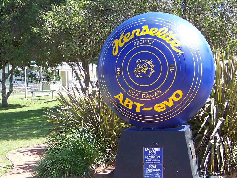
Lake Cathie Bowling and Recreation Club is home to the Big Bowl. Said to be the world's biggest it stands almost 2m tall and weighs two tonnes! It's only a short detour of about 10kms from Highway One. |
||
| Port Macquarie | ||
Port Macquarie (pop. 39,219) was established in 1821 as a penal settlement for convicts who had committed a secondary crime. The convict past adds a unique dimension to the town's rich historical legacy. |
||
| Telegraph Point | ||
 Full.jpg)
Until the 1970s, Old Highway One used to cross the Wilson River over a remarkable old 1900 opening bridge, pass through Telegraph Point (pop. 674) on Rollands Plains Rd and then continue north on Cooperabung Dr (the old alignment also continues south of the river
as Mooney St). |
 Full.jpg)
Although considerably smaller now than in its heyday (locals say it was once bigger than Port Macquarie), there are still lots of reasons to visit Telegraph Point. These classic old shops on Old Highway One harken back to busier times. |
 Full.jpg)
Old Highway One leading north out of Telegraph Point is now just a country byway. |
| Cooperabung | ||
 Full.jpg)
"Hillclimb" Former and Abandoned Alignment - the southern section (1km) provides access to local properties and is an interesting drive with traces of the old yellow centre lines still visible. |
 Full.jpg)
"Hillclimb" Former and Abandoned Alignment - the northern section is now home to the Mt Cooperabung Hillclimb of the Kempsey Car Club and access is blocked by a locked gate - it must have been an interesting section of road! |
|
| Kundabung | ||
 - Old Pacific Highway south end - end of road (23 Feb 2010) Full.jpg)
Old Pacific Highway south of Kundabung is a great 1.8km drive bypassed in 1974 and again featuring the famous old yellow centre line. As per usual practice, the old road isn't maintained after the last property to the south and is quickly blocked by fallen trees. |
 Full.jpg)
Look out just west of the modern highway bridge north of Kundabung for the 1955 Maria River Bridge; decommissioned in 2008, along with a short stretch of abandoned Old Highway One approach road. The old bridge was the first composite concrete and timber bridge of its kind and formed a template for many bridges built thereafter. |
|
| Kempsey | ||
 Full.jpg)
Kempsey (pop. 8,137) traces its settlement back to the mid-1800s. Kempsey is famous as the home town of country singer Slim Dusty and the new Slim Dusty Centre is in advanced construction. The factory for famous Australian Akubra Hats is in
South Kempsey. Kempsey was bypassed by a major new motorway-standard section of road in March 2013. Aligned east of the town, construction of the bypass began in mid-2010. It runs from south of Kempsey to east of Frederickton and features the longest road
bridge in Australia (3.2km over the Macleay River and its floodplain). |
||
| Frederickton | ||
 Full.jpg)
Bypassed along with Kempsey in 2013 and dating back to the 1840s, Frederickton (pop. 986) is well worth a pause. Be sure to visit the classic Macleay River Hotel. |
 Full.jpg)
"Christmas Creek" Abandoned Alignment - south of Frederickton, look out on the west for an old 500m Old Highway One alignment now totally inside private property - strange to see the old road passing through a private gate. Further north there are more glimpses of the old road across the fencing. |
|
| Gladstone | ||
 Full.jpg)
North of Frederickton look out on the east for Smithtown Rd and a short 5km detour to visit the intact historic village of Gladstone and its close neighbour Smithtown; highly recommended. |
 (24 Feb 2010) Full.jpg)
Gladstone Hall (School of Arts)(1896). |
 (24 Feb 2010) Full.jpg)
Gladstone's Heritage Hotel (1874). |
 Full.jpg)
Construction began in 1919 on St Barnabas Anglican Church in Gladstone. |
 Full.jpg)
Gladstone's 1921 Uniting Church. |
|
| Warrell Creek | ||
 Full.jpg)
"Warrell Creek" Former Alignment - an interesting 1987 2km Old Highway One alignment passes along Albert Dr through the tiny townships of Warrell Creek and Donnellyville. Look out for the old petrol station under conversion to a residence at the south end. |
||
| Macksville | ||
 Full.jpg)
The tourism, oyster farming and regional service centre of Macksville (pop. 2,658) was established in the late 1800s. There are interesting Old Highway One alignments both north and south of the Nambucca River. |
 Full.jpg)
An old service station on Old Highway One in south Macksville. |
 Full.jpg)
Macksville's 1931 Nambucca River bridge. |
 Full.jpg)
Historic Nambucca Hotel in Macksville is another welcoming country pub. |
 Full.jpg)
There's lot's to learn at Macksville's Mary Boulton's Pioneer Cottage & Museum. |
 Full.jpg)
Macksville's former Nambucca Valley Motors is also on Old Highway One in Macksville. |
 Full.jpg)
A substantial former bank in Macksville now serves as professional offices. |
 end of road (24 Feb 2010) Full.jpg)
Bellevue Dr and Nursery Rd, now joined only by a pedestrian bridge built on the site of the old road bridge, form the pre-1974 alignment of Old Highway One north of the river in Macksville. |
|
| Nambucca Heads | ||
 Full.jpg)
Nambucca Heads (pop. 5,873) is another of those charming holiday and retirement towns that dot the north coast of New South Wales. Established in the late 1800s, it's beautifully located at the mouth of the Nambucca River with easy access to great surf beaches and
still has that typical laid-back and relaxed feel. |
||
| Urunga | ||
 Full.jpg)
Pre-1955 Old Highway One used to wind an interesting 2.5km route through Urunga (pop. 2,687). |
||
| Raleigh | ||
 Full.jpg)
Various parts of Old Highway One around Raleigh and Repton were bypassed around 1950, other parts in the late 1990s and a long section near Bonville was bypassed as recently a 2008-09. |
||
| Coffs Harbour | ||
 Full.jpg)
Coffs Harbour (pop. 22,734) is one of the major north coast resort towns. Established in the late 1800s it is a booming destinations for holiday makers and retirees alike. |
 Full.jpg)
The Big Bunch of Bananas adorns Cunningham's Bananas on the Pacific Highway on the south side of Coffs Harbour. |
 Full.jpg)
The Big Windmill is an unmissable part of The Windmill Motor Lodge motel and restaurant complex and has been welcoming travellers to Coffs Harbour since 1982. |
| Arrawarra Beach | ||
 (26 Feb 2010) Full.jpg)
An excellent 1980s Old Highway One relic stretches north and south of Arrawarra Beach Rd. |
||
| Corindi Beach | ||
 wierd sclpture (26 Feb 2010) Full.jpg)
Until the 1980s Old Highway One passed through the western part of Corindi Beach. Just to the north, Blackadder Rd was the northern extension of this alignment and is now partly abandoned and partly still serving some homes. The junction of Blackadder Rd and Coxs Lane is the site of some unusual, shrine-like pieces of roadside sculpture on private property. |
||
| Dirty Creek Range | ||
 (26 Feb 2010) Full.jpg)
Dirty Creek Rd and its western continuation Falconers Ln were a 1980s Old Highway One Alignment, but are now separated by a deep Pacific Highway road cutting. |
||
| Grafton | ||
 Full.jpg)
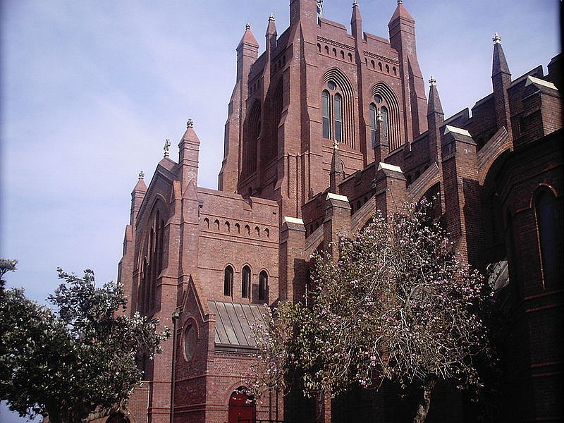
With its substantial town centre and beautiful setting on the Clarence River, elegant Grafton (pop. 17,501) demands more than a passing glance. Established in the mid-1800s, Grafton also has a wonderfully rich historical legacy to explore. Be sure to drive into Grafton and over the unusual 1932 double-level "bendy" bridge with road above and rail and pedestrians below. It also features a (no longer functioning) bascule span and a sharp kink in the road at both ends where the rail and the road match alignments over the bridge.Pick up a Heritage Walk guide at the Tourist Information Centre on the Pacific Highway in South Grafton or at the friendly Clarence River Historical Society at 190 Fitzroy St. |
 Full.jpg)
Grafton's wonderful Breimba St fig trees. |
 (11 Nov 2010) Full.jpg)
Christ Church Anglican Cathedral (1884) in Grafton. |
(26 Feb 2010) Full.jpg)
Grafton's Courthouse (1880). |
 (11 Nov 2010) Full.jpg)
Stylish Fitzgeralds Chambers (1908) in Grafton. |
 Full.jpg)
Grafton's 1935 Grafton Hotel. |
 Full.jpg)
Stately 1901 Schaeffer House is home to the Clarence River Historical Society Museum in Grafton. |
 (11 Nov 2010) Full.jpg)
Grafton's old NAB Building (1887) is now a restaurant. |
 (11 Nov 2010) Full.jpg)
Grafton's historic Post Office (1877). |
 Full.jpg)
Historic 1860 Post Office Hotel in Grafton. |
 Full.jpg)
Grafton's 1870 Roches Family Hotel. |
 (11 Nov 2010) Full.jpg)
St Andrews Presbyterian Church (1886) in Grafton. |
 (11 Nov 2010) Full.jpg)
Grafton's Village Green Hotel (1880). |
 (26 Feb 2010) Full.jpg)
Grafton's lovely Weileys Hotel (1909). |
|
| Swan Creek | ||
 Full.jpg)
The "Wyatt Straight" Old Highway One alignment is a fascinating 1.2km old alignment of 1932 concrete road bypassed in 1989 and well worth a short detour. The north-south section is used to test or calibrate line-marking machines and the road is now almost white with paint. A local farmer who has lived here all his life says that the local young guys used to race their cars around the curve here. |
||
| Ulmarra | ||
 Full.jpg)
"Ulmarra" Former Alignment - Ulmarra (pop. 446) is a historic, former river port first established in the 1850s and remains amazingly intact; don't pass it by on the highway as the main street (Coldstream St) is a beauty and the 1929 Ulmarra Hotel demands a stop. Bypassed before World War II in pre-Highway One days, the 800m of old road nowadays is just a peaceful small-town street. |
 Full.jpg)
Ulmarra's 1912 former Our Lady Help of Christians Catholic Church closed in 2010 and was the last of the churches in town to close. |
 Full.jpg)
Until the future Grafton bypass is built, modern Highway One passes noisily through the middle of Ulmarra. Sad that the classic old NR1 shield is now an endangered species! |
 Full.jpg)
1929 Ulmarra Hotel is a classic old pub with nice leafy grounds. |
||
| Cowper & Brushgrove | ||
 (27 Feb 2010) Full.jpg)
"Cowper" Former Alignment - Clarence St is a 1.7km former Highway One alignment, bypassed in 1993 after a series of accidents and the tragic Cowper Bus Crash in 1989. The old road no longer joins the modern highway at the east end and a small park there contains a commemorative plaque about the bus crash. Cowper (pop. 431) and Brushgrove (pop. 151) are twin small towns facing each other across the Wingfield Bridge over the Clarence River. |
 Full.jpg)
The 1868 Brushgrove Hotel beckons alluringly across the Clarence River bridge! |
 Church (in gounds of Brushgrove Uniting Church) (12 Nov 2010) Full.jpg)
Historic 1898 former St Judes Church in Brushgrove stands in the grounds of its (quite old) successor building. |
 Full.jpg)
An inviting and leafy private residence in Brushgrove. |
||
| Shark Creek | ||
 Full.jpg)
Immediately west of the modern highway bridge across Shark Creek is an iconic old 1936 reinforced concrete bowstring arch bridge. It carried traffic for 50 years and even has the old yellow centre-line still in place. The "Shark Creek" former and abandoned Old Highway One alignments are north and south of the old bridge. |
||
| Maclean | ||
 (12 Nov 2010) Full.jpg)
Maclean (pop. 2,311) is overflowing with history and things to see and do; even one full day here isn't really enough. |
 (12 Nov 2010) Full.jpg)
Maclean's former Methodist Church (1890). |
 (12 Nov 2010) Full.jpg)
Historic Free Presbyterian Church (1867) in Maclean. |
 Full.jpg)
Maclean's 1903 Maclean Hotel is a great option for meals and accommodation. |
 Full.jpg)
This colourful mural at the Maclean Hotel proudly remembers the town's Scottish heritage. |
 Full.jpg)
The Clarence Hotel in Maclean. |
 Full.jpg)
Macleans 1930s and VERY Art Deco former Hollywood Picture Palace is now home to several shops. |
 abandoned service station (27 Feb 2010) Full.jpg)
A wonderful mid-1960s 7.5km Old Highway One alignment leads through Maclean and then along the banks of the Clarence River to the interesting 1966 steel truss bridge at Harwood. This abandoned service station is near the north end of the old alignment and bears testament to its busier past, |
|
| Chatsworth Island | ||
 Full.jpg)
A relaxed 9km 1980s loop of Old Highway One serves the tiny riverside village of Chatsworth Island. There are leafy tables opposite the General Store and look out for the "thong tree", the "tooth brush tree" and the "tree of knowledge" and its attendant gnomes; all good fun! |
 Full.jpg)
Chatsworth Island's St Lukes Anglican Church is a well-maintained and typical timber country church. |
 Full.jpg)
Charming old rustic shed on Old Highway One, Chatsworth Island. |
 Full.jpg)
The view of the mighty Clarence River at Chatsworth Island. |
 Full.jpg)
The Chatsworth Island "Community Thong Tree". |
 Full.jpg)
One of several shady picnic tables at Chatsworth Island. |
 Full.jpg)
Chatsworth Island's Shark Bay! |
 Full.jpg)
The Tree of Knowledge at Chatsworth Island is a cute diversion. |
|
| Woombah | ||
 Full.jpg)
"Woombah" former and abandoned Old Highway One alignment - a 1990s old loop runs north and south of Iluka Rd, still drivable in parts. |
||
| Jacky Bulbin Flat | ||
 Full.jpg)
"Jacky Bulbin Flat" former Old Highway One alignment - a 900m excellent unsigned old alignment just east of the modern highway leading to some old timbers marking the former site of a road bridge. The famous old yellow centre line is still visible here. |
||
| Trustums Hill | ||
 - old H1 as rest area north end (27 Feb 2010) Full.jpg)
"Trustums Hill" former Old Highway One alignment - a late 1990s alignment still operating as a local service road and continuing east of the highway as a combination service road and rest area. |
||
| Broadwater | ||
 Full.jpg)
Broadwater (pop. 463) is built around its 1881 sugar mill. The beautiful timber 1925 former St Columbkille's Catholic Church has now been renovated as a coffee shop. |
||
| Empire Vale | ||
 Full.jpg)
Before the 1964 Wardell bridge was built, Old Highway One crossed the Richmond River via a still-operating ferry between West Ballina and South Ballina. On its way to the ferry the old road hugs the south bank of the Richmond River, passing through tiny Empire
Vale and even tinier Keith Hall. |
||
| Ballina | ||
 Full.jpg)
Until the early 1980s Old Highway One passed through downtown Ballina (pop. 16,477), a service and tourist-oriented town serving as the gateway to the Richmond Valley hinterland to the west and north-west and the magnificent beaches to the east and north. It
was realigned a couple of blocks west as a traffic-mitigation measure. A major western bypass of Ballina was fully opened in April 2012. |
||
| Knockrow | ||
 Full.jpg)
Look out west of the Pacific Highway just north of Knockrow for the Big Knight, standing guard over the Macadamia Castle at Knockrow. He's one of the newer Highway One "Big Things". |
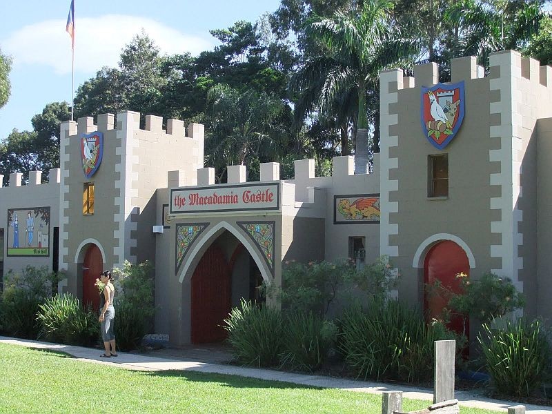
Macadamia Castle at Knockrow. |
|
| Newrybar | ||
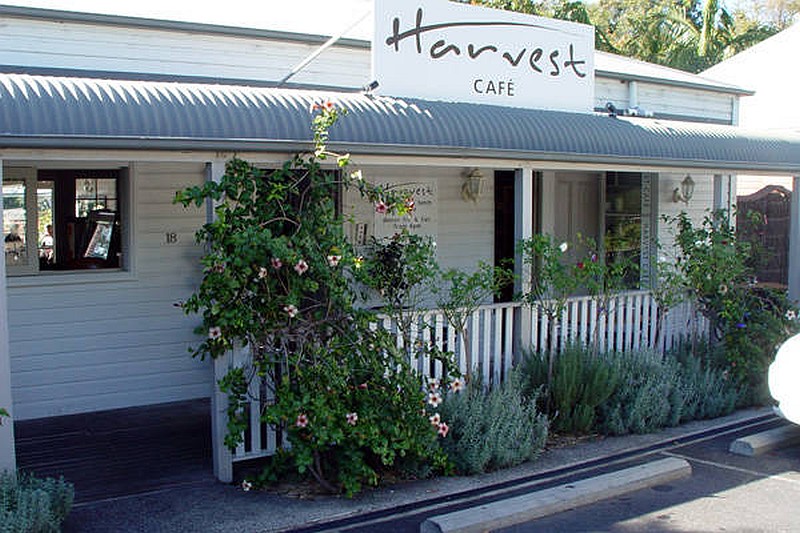
A classic 1960s former Old Highway One alignment runs 500m through pretty little Newrybar (area pop. 581). Check out the busy Harvest Cafe, housed in an early 1900s cottage, and the other interesting shops and buildings. |
||
| Bangalow | ||
 Full.jpg)
A winding 1.9km Old Highway One alignment through the centre of Bangalow was bypassed in 1994. Another major bypass is under construction (as at 2014) to bypass Bangalow and Newrybar to the east; more Old Highway One in the making! Bangalow (pop. 1,327) is a classic Northern Rivers small town that has reinvented itself to be now a thriving historic, market and art and craft centre for the region. |
 Full.jpg)
Bangalow's All Souls Anglican Church has a striking bell tower (pardon the pun)! |
 Full.jpg)
The Bangalow Hotel, built in the 1940s, has a very Art Deco feel. |
 Full.jpg)
Decorated building in Bangalow. |
 Full.jpg)
Don't Tell Mama about Bangalow! |
 (26 Jun 2008) Full.jpg)
A former Church now operating as a pottery in Bangalow. |
| Ewingsdale | ||
 Full.jpg)
An interesting 450m dead-end late 1990s alignment runs south of Ewingsdale Rd as William Flick Ln; it's a wonderful grand avenue of figs. The old alignment (as Woodford Ln) also continues for over 2km north of Ewingsdale Rd as a dead-end service road. |
 Full.jpg)
Peaceful 1915 St Columba's Anglican Church at Ewingsdale. |
|
| Mullumbimby | ||
 (18 Apr 2008) Full.jpg)
Up until the end of World War II the Pacific Highway followed a VERY scenic loop through Mullumbimby, rejoining the main route just south of Billinudgel. It's an interesting, scenic and in places very twisting old-style drive, but unfortunately bypasses pretty
Brunswick Heads. |
 Full.jpg)
1925 St Martins Anglican Church is a great asset for Mullumbimby with its excellent organ, timber interior and lovely stained glass windows. |
 Full.jpg)
A sample of the stained glass windows in 1925 St Martins Anglican Church in Mullumbimby. |
| Brunswick Heads | ||
 Full.jpg)
Bypassed in the late 1990s, another Old Highway One alignment passes east of Mullumbimby and through Brunswick heads, becoming the Brunswick Valley Way north of town and winding its scenic way north past Billinudgel. Brunswick Heads
(pop. 1,614) is a charming holiday destination and also was formerly home to a large fishing fleet. |
 Full.jpg)
An attractive Art Deco pharmacy in Brunswick Heads. |
 (14 Sep 2011) Full.jpg)
Brunswick Heads' lovely timber-built St Thomas' Anglican Church (1922). |
| Billinudgel | ||
 Full.jpg)
The interesting little village of Billinudgel lies just west of the Brunswick Valley Way (Old Highway One). It has an interesting main street that is home to the historic 1906 Billinudgel Hotel. |
 Full.jpg)
Historic Billinudgel Store. |
 Full.jpg)
Billinudgel's abandoned Railway Station was looking much the worse for wear back in 2008, however, local volunteers have since given it a well-deserved restoration. |
| Mooball | ||
 Full.jpg)
Tiny Mooball is home to famous moo-cow pattern telephone and power poles, interesting shops and the 1932 Hotel Victory (the hotel was unbelievably busy back when Highway One passed by, but not so much now). |
 Full.jpg)
Mooball's Moo Moo Cafe was once a crazy-busy stopover with its own souvenirs, mini-museum etc. but with the 2002 bypass came a slow decline and eventual closure. Great news in 2013 when it reopened as the Moo Moo Roadhouse with a great new look, classic vehicles and motoring displays and a new presence. |
 Full.jpg)
Another feature in Mooball is the lovely 1934 Art Deco Kelly Brothers store. |
| Burringbar | ||
 Full.jpg)
Burringbar (pop. 557) is a pleasant small town with shops and a nice park and even with its own tiny loop of even older bypassed Old Pacific Highway. |
||
| Murwillumbah | ||
 Full.jpg)
Guarded by Mt Warning and dating back to the 1870s, Murwillumbah (pop. 7,952) is a stunning subtropical small town set in the magnificent heart of the old extinct volcano's caldera. Still a thriving agricultural service centre and yet with a cafe scene,
surrounded by the border ranges and close to the ocean surf beaches to the east and the World Heritage rainforest all around, it really has it all. Visit the World Heritage Rainforest Centre for local information and an overview of this unique place. |
 (17 Dec 2007) Full.jpg)
Parts of the centre of Murwillumbah were destroyed in a catastrophic fire in 1907. The 1909 Courthouse is an example of the rapid rebuilding that took place subsequently. |
 Full.jpg)
Stylish and iconic 1931 Imperial Hotel is the third incarnation of the hotel on the site dating back to the late 1890s. |
 Full.jpg)
1915 Tweed Regional Museum - Murwillumbah (in the old Council Chambers) was refurbished and extended in 2013-14. |
 Full.jpg)
A beautifully maintained old shop in Murwillumbah's main street. |
 Full.jpg)
Murwillumbah's 1940s (but still very Art Deco) Regent Cinema. |
 Full.jpg)
Murwillumbah's 1924 Credit Union Building is a former CBA Bank. |
 Full.jpg)
Murwillumbah's early 1900s St Andrews Presbyterian Church. |
 Full.jpg)
Prettily-decorated Tweed House is another architectural highlight in Murwillumbah. |
| Tumbulgum | ||
 Full.jpg)
Tumbulgum (pop. 349) was first established as far back as the 1860s. Although its location at the confluence of the Tweed and Rous Rivers made it an important early river port and a rival to Murwillumbah, today it is a picturesque small village popular with locals and visitors alike. Until 1972 Old Highway One used to hug the riverbank right through town. |
 Full.jpg)
A lovely riverside picnic area in Tumbulgum fronting the beautiful Tweed River. |
 (17 Dec 2007) Full.jpg)
Tumbulgum's former St Peters Anglican Church dates back to 1954. |
 (17 Dec 2007) Full.jpg)
1913 Tumbulgum Hall fronts Old Highway One through the town. |
 Full.jpg)
The Tumbulgum Tavern (the "Tumby Pub") has been licensed since 1887 and is a VERY popular stop for meals and a drink. |
|
| Chinderah | ||
 Full.jpg)
Old Highway One (now badged Tweed Valley Way/Tourist Drive 40) rejoins modern Highway One (Pacific Motorway) near Chinderah in this photo taken before the famous old National Route 1 shields were coverplated with the new A1 badges in 2013. Just to the north, Chinderah Bay Dr is another Old Highway One stretch, bypassed in the 1990s, again hugging the banks of the Tweed River. |
||
| Tweed Heads | ||
Old Highway One used to reach the Queensland border by a very circuitous and winding route culminating in a busy but interesting transit through the urban area here. A series of bypasses and upgrades on both sides of the border have improved travel times
for through travellers and the final bypass was completed at Banora Point in 2012. |

|

|
|
|